
15.4. Cyclogenesis Stage#
For cyclogenesis to occur at the surface, a wave in the upper-levels must come along to provide the necessary support to strengthen the low-level temperature gradient. This stage is signified by an increasing temperature gradient, the beginning of cyclonic flow at the surface, and a small decrease in the mean sea-level pressure (Fig. 15.2). There are now fronts defined with a warm front typically east of the cyclone center and a cold front south and west of the cyclone center. The pressure troughs in association with the fronts begin to develop.
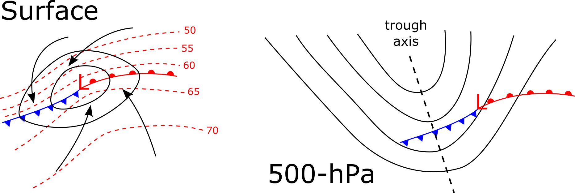
Fig. 15.2 A schematic diagram of a surface cyclone during the cyclogenesis stage of development at the surface and 500 hPa with location of low-level fronts for spatial reference.#
As the initial cyclone begins to develop, the trough begins to intensify simultaneously. The intensification results from the different temperature advection surrounding the mid-latitude cyclone. The 500-hPa pattern strengthens (Fig. 15.2) along with the surface cyclone and is evidenced by the deepening of the upper-level trough. Additionally, a typical mid-latitude cyclone exhibits a tilt with height. The typical tilt is where the upper-level trough (e.g., the 500-hPa trough) is located to the west of the surface mid-latitude cyclone (Fig. 15.2). This westward tilt with height is essential to the continued strengthening of the mid-latitude cyclone.