
14.4. Smooth Field#
Use the smooth_field smoothing for data with finer resolutions (e.g., smaller grid spacings with a lot of grid points). This will produce smoothed geopotential heights for all levels available in the DataArray using the nine-point smoother twice or the number of iterations given as an integer.
MetPy smooth_field Documentation
Here is an example (Fig. 14.1) of using smooth_field,
notice how the black contours,
which have had no smoothing applied, are not smooth over the Rocky Mountain
region whereas the red contours, which have been smoothed through four iterations,
are noticeably smoother over the mountain region.
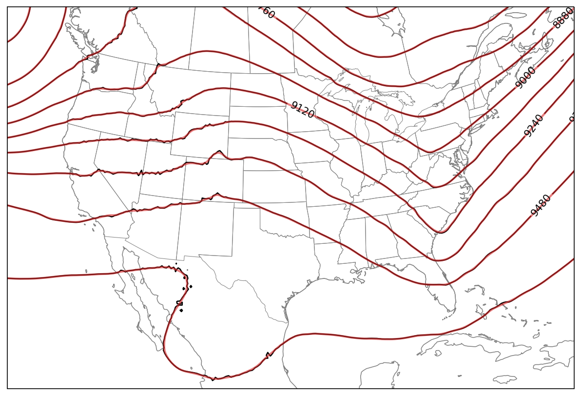
Fig. 14.1 This map shows 300-hPa heights in solid black contours and smoothed contours using the smooth_field attribute in red.#